Renewable Energy in North Dakota Story Map
This story map outlines extensive geospatial analysis that I conducted as a part of Professor Sarah Mill’s Energy Planning Course to identify potential siting concerns for renewable energy development in North Dakota.

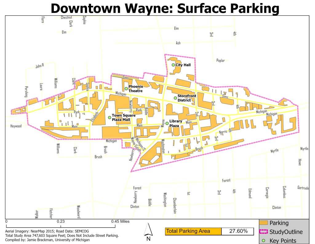
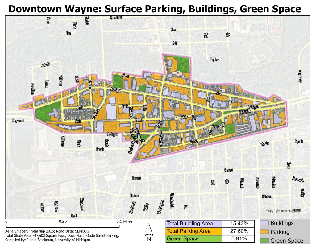
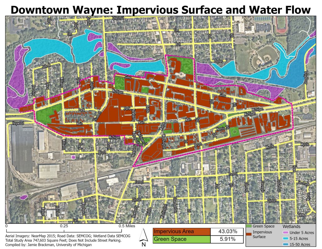
City of Wayne Parking Reform
As part of ongoing efforts by the City of Wayne to promote economic development downtown, this project was conducted in partnership with McKenna and Professor Larissa Larsen of the University of Michigan Taubman College. In this project I worked with zoning overlays and satellite imagery in order to estimate the total surface-area dedicated to parking, buildings, and green space. The analysis also provided preliminary insight on the amount of impermeable surface in the district.


Michigan C1800s Natural Communities to Present Conditions
This web app contains a number of publicly available layers that allows users to compare an area’s Circa 1800s natural community type with its current natural conditions. This independent project could be useful for conservation planners, ecosystem restoration projects, or other land-use planning efforts.

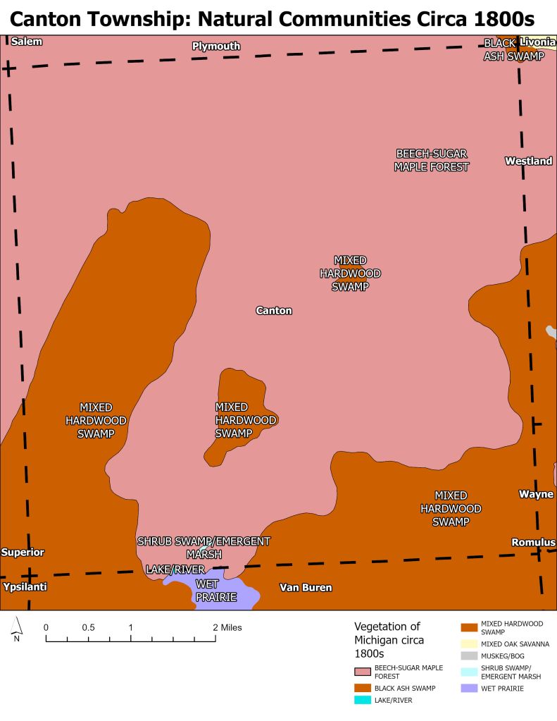
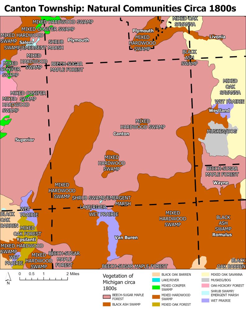
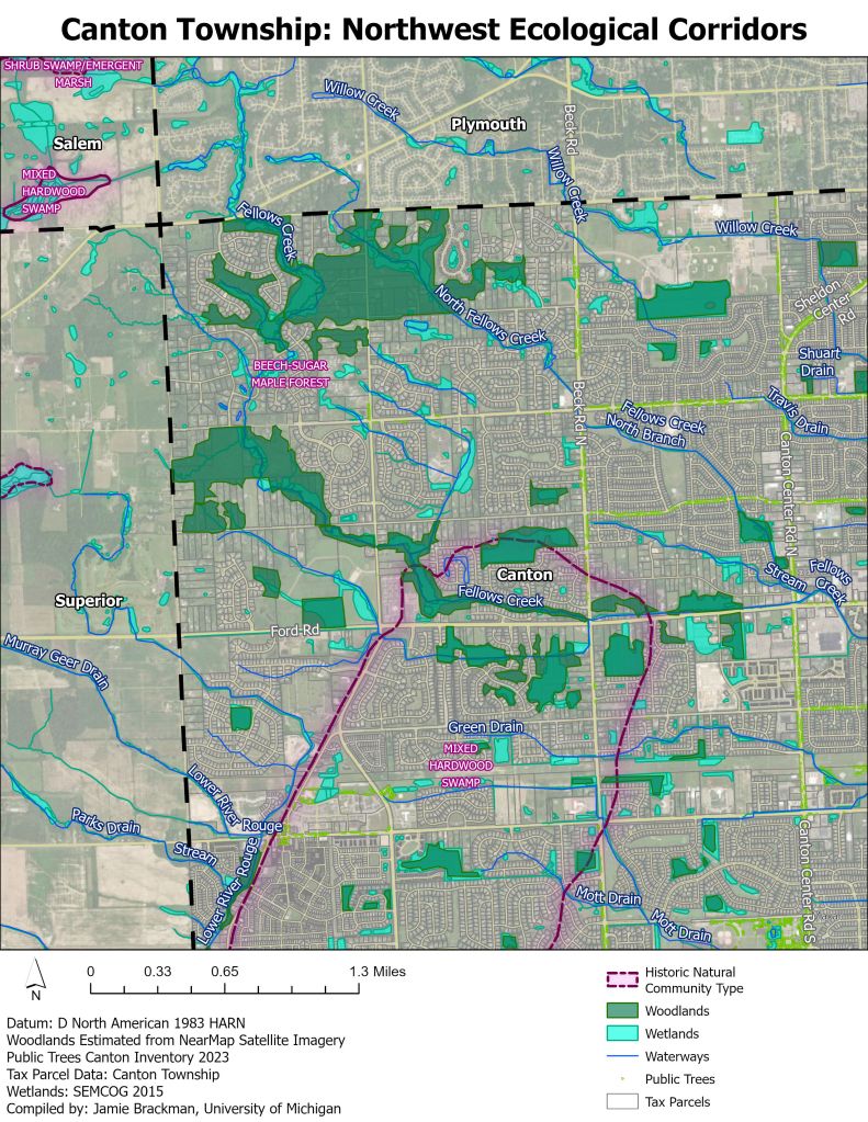
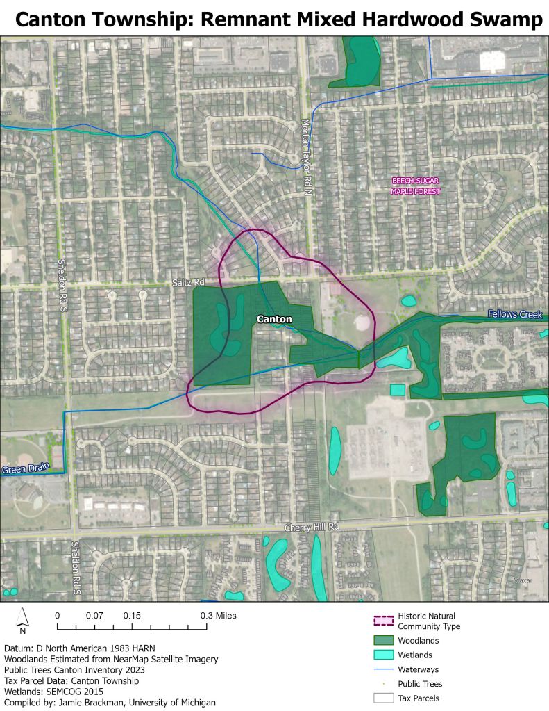
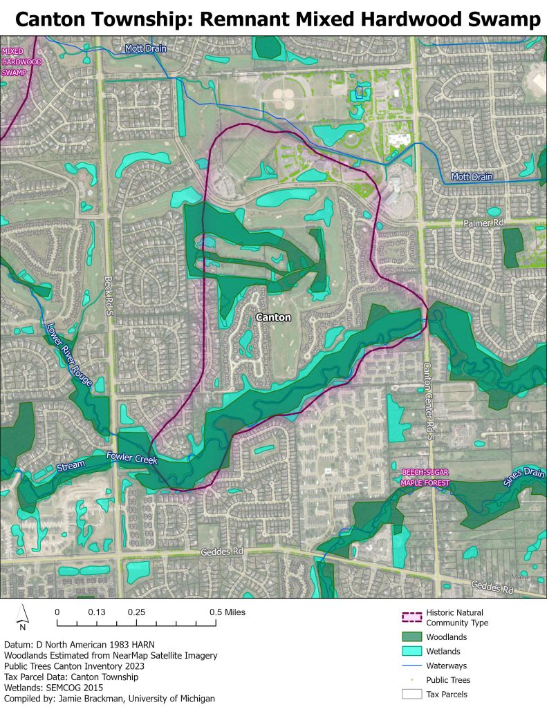
Canton Township Urban Forestry and Natural Communities
These maps were created to support Canton Township’s Urban Forestry efforts in partnership with Professor Richard Norton and The University of Michigan Taubman College Urban Planning Program. The maps document the historic natural community type in Canton Township and the surrounding region and highlight areas where remnant natural communities may still occur. Current Canopy coverage was derived from satellite imagery and manually drawn, then cross referenced with the townships own canopy data. These maps demonstrate the major loss of wetlands and forests in Canton, and support efforts to conserve canopy and natural areas in the township.


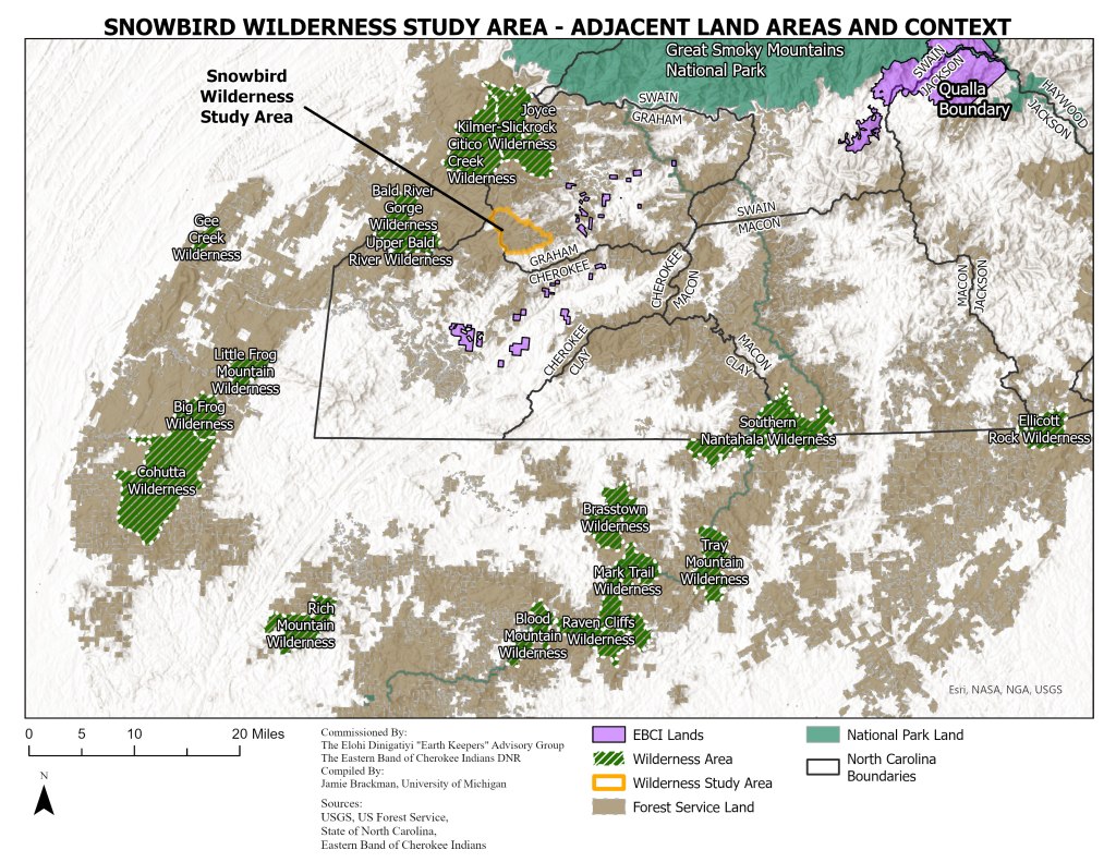
Snowbird Wilderness Study Area Maps – EBCI
This series of maps was commissioned by the Elohi Dinigatiyi “Earth Keepers” Advisory Group and the Eastern Band of Cherokee Indians (EBCI) Department of Natural Resources (DNR) as a part of a University of Michigan Capstone Project led by Professor of Practice Andy White. These maps highlight the land context surrounding the Snowbird Wilderness Study Area, one of the focus areas of the capstone project. Notable cultural and ecological features are highlighted on the map which has supported the Eastern Band’s ongoing planning efforts.